RockHoundR: Rockhounding Map
- 4.4
- Rating
- 10.00K
- Installs
- Free
- Price

 Analysis by App-foxy
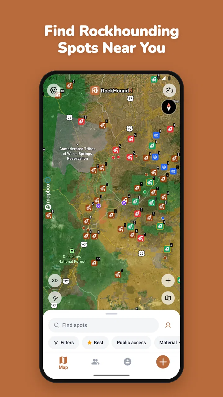
I approached RockHoundR: Rockhounding Map as a practical field companion rather than a general-purpose navigation replacement. Its purpose is narrow and appealing: help people find places connected with rockhounding, then use a map to plan where to look for rocks, gems, and minerals. That focus immediately makes it more interesting than a standard map app for collectors, families, geology students, and curious travelers who want their next outing to have a clear goal.
My overall impression is positive, but I would describe it as a specialized starting point, not a complete trip-planning system. The app is free to install, carries an Everyone age rating, and comes from Ruby Glint Technologies. It has reached over ten thousand installs and holds a 4.4 average from 66 ratings, which suggests a small but generally receptive audience. The current version is 1.9.0, and it runs on Android 7.0 or later.
The most important thing to understand before using it is what kind of help it offers. This is a map for discovering possible rockhounding locations, not a promise that every marked place will be easy to reach, legally open, safe, or productive on the day you visit. I found its value strongest during the research stage, when I wanted to turn a vague idea such as “find interesting minerals nearby” into a shortlist of places worth investigating.
You May Also Like

 Pandora - Music & Podcasts
Pandora’s Music Is Easy to Start, but Harder to Recover
Pandora’s strength is its low-effort path from a seed to a station. Its weak spot is how much confidence it asks you to place in connection, setup, and quiet recovery.

 8 Ball Pool
 Is Built on Rivalries, Rematches, and Routine
A close look at the rivalries, rematches, shared routines, and unanswered safety questions that turn a quick pool match into a persistent mobile community.

 Samsung Music
’s Quiet Strength Is Playing What You Already Own
Its reach comes less from spectacle than from dependable access to a personal library. That simplicity is both the app’s strongest retention engine and its ceiling.

 AccuWeather: Weather Radar
AccuWeather Review: A Quick, Clear Forecast for Everyday Decisions
For everyday plans, the best forecast is the one you can understand quickly. AccuWeather makes rain timing, radar, and local conditions easy to act on, with a few trade-offs.

 Hill Climb Racing
Why Hill Climb Racing Still Turns Crashes Into One More Run
A tiny car, a bumpy hill and one more upgrade: Hill Climb Racing keeps resurfacing because its simple chaos makes every near-miss feel personal.

 AliExpress - Shopping App
AliExpress Makes Global Shopping Feel Personal, but Shoppers Bear the Risk
AliExpress turns a global marketplace into a pocket-sized discovery engine. Its reach is useful, its shopping loop compelling, and its trade-offs easy to miss.
More From Our News Desk
View All News


How clearly the map supports different readers and explorers
I see this section as a closer look at how the map’s focused purpose can serve beginners, experienced collectors, families, and people planning around different access needs. I’d use it to separate what a location map can help a reader consider from the decisions that still depend on individual circumstances. That distinction also makes it easier to choose a sensible next step before committing to an outing.
Readable information for a focused task
A specialized map can be easier to understand than a crowded general navigation app because the central question is simple: where might rockhounding make sense? That focus matters for first-time collectors. Instead of beginning with a blank map and searching through broad categories, you can approach the screen with a particular activity in mind.
I would use the app first at home, where I can examine the map without rushing. The useful workflow is to look for a promising area, compare it with the surrounding road network, and then make a separate note of what still needs checking before leaving. This two-stage approach is especially helpful for people who find dense map screens tiring or who need more time to interpret location information.
For readers who rely on clear visual grouping, the map concept should feel more direct than a list of unrelated attractions. At the same time, map-based information always asks the user to interpret symbols, positions, and distance. Someone with limited vision may need device-level magnification, a larger display, or assistance from another person. I would not treat the app as automatically accessible simply because its purpose is straightforward.
One practical tip is to avoid making decisions from a single glance. A marker can identify an area of interest, but it does not by itself answer whether the site is public, reachable, suitable for a wheelchair, safe for children, or appropriate for collecting. I recommend treating each location as a research lead. Confirm the route, land access, terrain, weather, and local rules before building a day around it.
Navigation without assuming every user travels the same way
The app belongs to Maps & Navigation, but I would not use it as my only navigation tool once I am on the road. A dedicated driving, walking, or transit app is usually better at turn-by-turn guidance and live route decisions. RockHoundR has a more valuable role earlier in the process: helping me decide which destination deserves a closer look.
This distinction is important for people with different mobility needs. A location that looks close on a map may still involve a rough trail, steep ground, loose stones, a long walk from parking, or a route with no suitable stopping point. The map can help identify where to investigate, but the user still needs another source of information to judge physical access.
For a family outing, I would use the app while planning at the kitchen table, then switch to a familiar navigation tool for the drive. I would also save the location details in a written itinerary, because relying on a map screen alone can become awkward when attention is divided between children, equipment, traffic, and changing weather. This is one of the app’s clearest trade-offs: it can improve discovery without replacing the rest of the travel toolkit.
Useful for beginners, with a learning curve around interpretation
Rockhounding newcomers may appreciate the focused subject matter, especially if they do not yet know where to begin. The app gives the trip-planning process a concrete shape: identify a possible area, learn more about it, prepare suitable tools, and decide whether the outing is realistic.
However, the map should not be mistaken for a field guide. Finding a location does not necessarily tell you what you will find there, how difficult the search will be, or whether collecting is permitted. Beginners should pair the app with local geological references and official land-management information. That combination is more reliable than assuming a marker is a guaranteed source of valuable specimens.
A useful beginner workflow is to choose one accessible-looking destination rather than planning an ambitious route through several distant places. Use the map to narrow the options, then spend the remaining preparation time checking parking, walking conditions, regulations, water, sun protection, and whether the site suits the people joining you. This makes the app part of a safer decision process instead of the entire decision process.
Motor and sensory considerations in the field
Rockhounding itself can be physically demanding. It may involve bending, carrying equipment, walking over uneven ground, handling small objects, and spending long periods outside. The app cannot remove those demands, but it can help users think about them before leaving.
I would plan around the person with the least available energy or mobility in the group. If someone cannot comfortably walk far, the map should be used to identify a destination for further access research, not to promise that the collecting area will be practical. A companion can also prepare the route in advance and share the key location details verbally or in writing, reducing the need to operate a phone while moving over difficult ground.
For users with limited dexterity, the best approach is to do the detailed map work before the outing. Mark down the chosen area, nearby roads, and backup options while seated and unhurried. In the field, minimize repeated screen interactions. A phone mounted safely or carried in an accessible pocket may be easier than holding it continuously, although the app itself should never be used in a way that distracts from driving or creates a trip hazard.
Users with visual or sensory sensitivities may prefer a larger screen, increased system text size, reduced brightness, or a quieter planning environment. These are device-level adjustments rather than confirmed app features, so I see them as practical accommodations, not evidence of a dedicated accessibility mode. People who are sensitive to glare should also plan for the fact that outdoor map viewing can be difficult in direct sunlight.
A less obvious but important tip is to prepare an offline-friendly backup in human-readable form. Write down the destination name or location description, the planned meeting point, and an alternative plan. Even when a map is easy to read at home, outdoor glare, cold hands, gloves, low battery, poor reception, or sensory overload can make live phone use much harder. A printed note or shared message can prevent a small technical inconvenience from becoming a serious access problem.
Situational access: when the app is most helpful
The strongest use case I found is quiet preparation before a short trip. Imagine a weekend where I want to take a child or a first-time collector somewhere interesting without spending the day driving aimlessly. I can open the app, look for a nearby rockhounding possibility, compare several areas, and then investigate the most realistic choice using other sources. That is a meaningful improvement over searching the entire web with no geographic starting point.
It can also help experienced hobbyists organize a regional trip. Instead of choosing destinations only by reputation, they can use the map to think spatially and group possible stops. The trade-off is that a map encourages optimism: several markers can look conveniently close even when roads, terrain, property boundaries, or opening conditions make the route impractical. I would always convert the visual plan into a conservative itinerary with extra time and a fallback destination.
For travelers, the app may be useful when passing through an unfamiliar area and wanting to explore a hobby rather than visit standard tourist attractions. It can turn a long drive into a possible learning opportunity. Still, travelers should be especially careful about local rules. A place that appears promising may be on private land or subject to restrictions that are not obvious from a map view.
For educators and families, the app can support a lesson about landscapes, minerals, and responsible outdoor exploration. The map gives students a concrete way to connect geography with observation. I would frame it as a research exercise: choose a location, ask what evidence is needed before visiting, and discuss why “nearby” does not automatically mean “accessible.” That makes the tool useful even when a physical trip is not possible.
People who cannot participate in field collecting may still use the map for virtual planning, regional comparison, or learning about how geology shapes places. The app is not a substitute for an accessible outdoor experience, but it can support shared decision-making when one person researches and another decides what kind of visit is comfortable.
Where the app falls short for inclusive use
The biggest limitation is the gap between a location marker and a complete access picture. Users may still need answers about terrain, parking, toilets, shade, trail surfaces, distance from the vehicle, mobile coverage, and whether collecting is allowed. These details can determine whether a site is genuinely usable, yet they often require separate research.
That gap affects everyone, but it affects disabled users and caregivers more sharply because an inaccurate assumption can make an outing expensive, exhausting, or impossible. I would not recommend choosing a destination solely because it appears on the map. Use it to generate candidates, then verify the practical details with official sources, local authorities, landowners, or experienced local groups where appropriate.
Another barrier is the dependence on visual map interpretation. Someone who cannot comfortably distinguish markers or read small labels may need support. Likewise, users with cognitive disabilities may benefit from a simplified plan containing one destination, one route, and one backup rather than a screen full of possibilities. The app’s focused subject can reduce information overload, but it does not automatically solve it.
There is also a financial consideration. The app is free, but in-app purchases range from $6.99 to $49.99 per item. That means the initial download is easy to try, while some users may later face a meaningful choice about whether optional paid content or functions fit their budget. I would begin with the free experience and decide only after confirming that the app genuinely improves my planning routine.
The app is not the right choice for someone seeking comprehensive turn-by-turn navigation, detailed accessibility information, a complete mineral identification system, or guaranteed site conditions. A general navigation service is likely better for driving directions, while specialist geological references and local authorities are better for identification, land rules, and safety decisions. RockHoundR makes most sense between those tools, at the discovery stage.
How it compares with ordinary map apps
General map apps are excellent when I already know the destination. They can show roads, businesses, traffic, and familiar route information, but they are not designed around the question of where rockhounding might be worthwhile. Starting there can mean trying many searches, reading scattered pages, and manually building a list.
RockHoundR’s advantage is the subject-specific lens. It helps me think about a region as a collection of possible rockhounding destinations rather than simply a network of roads. That saves effort during discovery and makes the hobby feel more approachable to someone who has never planned this type of outing.
Its disadvantage is equally clear: the broader map app usually remains more useful for the final journey. I would not replace my normal navigation setup with this one. I would use RockHoundR to choose and compare possibilities, then rely on the tool that best handles the actual route and on authoritative sources for access rules.
Compared with a paper guide or a local club’s recommendations, the app is quicker for visual exploration, but a human source may offer richer context about current conditions, collecting etiquette, and realistic difficulty. The best arrangement is not either-or. I would combine the map with local knowledge, especially when planning for someone with limited mobility, a child, or a group with different comfort levels.
My practical verdict for different users
I recommend trying it if you are curious about rockhounding and want a focused way to discover possible places. It is particularly suitable for beginners who need a starting point, hobbyists organizing a regional outing, families looking for an educational destination, and travelers who enjoy geology-related stops. Its free entry makes experimentation straightforward, while the Everyone rating keeps it broadly approachable.
I would be more cautious if you need detailed accessibility information before committing to a trip. The app can support the first step, but it should not be the only source used to judge whether a location works for a wheelchair user, someone with limited stamina, a person sensitive to heat or glare, or anyone who needs dependable facilities.
I would also skip it if your main goal is ordinary navigation. For a daily commute, live directions, or a precise walking route, a general navigation app is the better tool. This product earns its place when the question is not “how do I get there?” but “which possible rockhounding place should I investigate first?”
After using it as a planning aid, I see the clearest value in its specialization. It gives a niche hobby a more approachable entry point and encourages users to explore locations they may not have considered. The responsible way to use it is to keep its role precise: discovery first, verification second, navigation third.
My inclusive recommendation is to treat RockHoundR as a flexible research companion, not an accessibility guarantee or a complete field-safety guide. With a larger screen, a written backup, a carefully chosen destination, and separate checks for terrain and permissions, it can support a wide range of planning situations. Without those extra steps, the map may look more certain than the real-world outing will be. That balance is why I find the app worthwhile for curious collectors, while still advising every user to verify the practical details before setting off.
FAQs for RockHoundR: Rockhounding Map
01What is RockHoundR: Rockhounding Map used for?
RockHoundR: Rockhounding Map is designed to help rockhounds discover and organize places where rocks, minerals, fossils, and other geological specimens may be found. It can be useful for planning field trips, researching collecting areas, and learning more about nearby geological locations. However, the information should be treated as a guide rather than a guarantee, because site conditions, access rules, and specimen availability can change over time.
02Does RockHoundR provide accurate locations for rockhounding sites?
The app can be a helpful starting point for finding potential rockhounding locations, but users should not assume that every map marker is perfectly accurate or currently accessible. Geological information may come from public records, user contributions, or other sources, and some locations may have limited detail. Before visiting, check official land-management information, recent local guidance, property boundaries, collecting restrictions, and safety conditions.
03Can I use RockHoundR offline while exploring remote areas?
Offline usefulness depends on the app’s current mapping and data features, as well as whether relevant information has been saved before leaving an internet connection. Remote collecting areas may have weak or nonexistent cellular service, so it is wise to prepare in advance by reviewing locations, downloading available map data, and carrying a physical map, compass, charged phone, or backup GPS device. Never rely on the app as your only navigation tool.
04Is rock collecting allowed at the locations shown in the app?
Not necessarily. A location appearing in RockHoundR does not automatically mean that collecting is legal or permitted there. Rules vary between private property, public land, parks, protected geological sites, mining claims, and fossil areas. Always confirm ownership, obtain permission when required, follow local regulations, respect quantity limits, and avoid collecting in restricted or environmentally sensitive areas. Responsible collecting also means leaving the site safe and undamaged.
05Is RockHoundR suitable for beginners, and what should new users bring?
The app can be useful for beginners because it gives them a way to explore possible collecting areas and plan trips before heading outdoors. New users should still learn basic rock and mineral identification, understand local regulations, and prepare for changing field conditions. Bring water, suitable footwear, sun protection, a first-aid kit, gloves, eye protection, a rock hammer where legal, collection bags, and a fully charged phone.
Pros
- Helps discover rockhounding locations with map-based exploration.
- Useful for planning trips around geological points of interest.
- Location details can make unfamiliar areas easier to investigate.
- Supports outdoor learning about rocks
- minerals
- and collecting sites.
- Convenient reference to keep on your phone during field trips.
Cons
- Coverage and accuracy may vary significantly by region.
- Some locations may require additional research before visiting.
- Map information may become outdated as access rules change.
- Outdoor use can depend on mobile signal and GPS accuracy.
- Collecting restrictions and private property boundaries still need checking.

RockHoundR: Rockhounding Map
Gallery